Hydrographic & Topographic Survey
Hydrographic Surveys
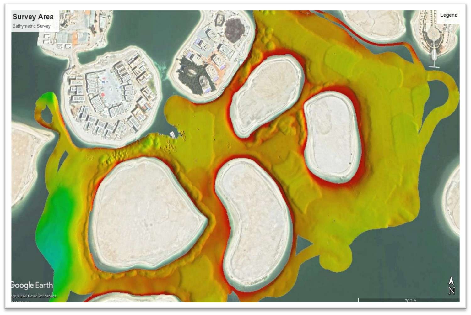
Hydrographic Surveys are conducted for obtaining information on water depth in Ports, Anchorages, Rivers, inland ways, Dams, Reservoirs etc., and is required for Navigation, project-cum-engineering, irrigation, tidal power, tourism, inland water ways, pre-dredging, progressive and post-dredging, Siltation, erosion, pollution, flood control etc.
Topographic surveys
Topographic surveys are performed to determine planimetric location and/or elevation of surface or subsurface features, facilities, utilities, and mapping of existing structures along with levels in a particular area. Sometimes control points have to be established in the vicinity of the survey area using locally available benchmark details.
Hydrographic Surveys: Purpose and Applications
Hydrographic surveys are essential for collecting detailed information on water depths in various aquatic environments such as ports, anchorages, rivers, inland waterways, dams, and reservoirs. These surveys support a wide range of applications including:
Navigation
Project and engineering planning
Irrigation and tidal power
Tourism and inland waterway development
Pre-, progressive, and post-dredging assessments
Monitoring siltation, erosion, and pollution
Flood control initiatives
The data obtained from hydrographic surveys informs critical decision-making in areas such as:
Vessel navigation
Resource management and development
Marine infrastructure and construction
Coastal development
Environmental monitoring
Tactical and strategic military operations
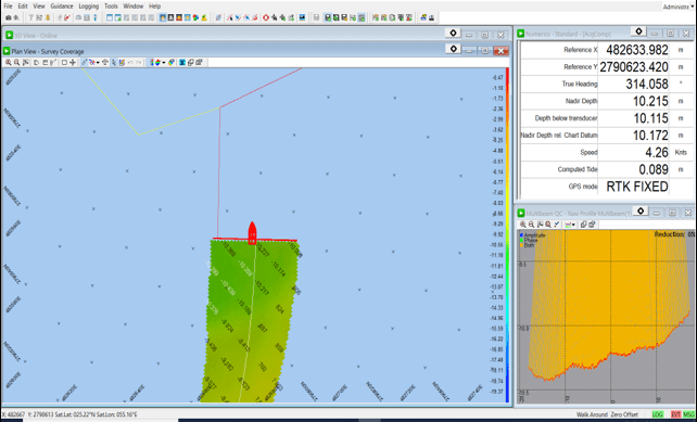
Survey Techniques: Single Beam vs. Multi-Beam
While single beam echo sounder (SBES) surveys have long been the industry standard due to their simplicity and lower cost, multi-beam echo sounder (MBES) surveys are increasingly being adopted. Advances in hardware, software, and computing power have made MBES systems more accessible and cost-effective. Compared to single beam systems, MBES offers:
Faster seabed mapping
Higher precision
Greater spatial resolution
IHO S-44 Standards: Survey Orders
The International Hydrographic Organization (IHO), through its S-44 4th Edition standard, classifies hydrographic surveys into four types based on their intended use:
Special Order
Reserved for areas where vessels operate with minimal under keel clearance.
Focuses on locations with potentially hazardous seabed features like boulders or rock outcrops.
Requires the highest level of positional and depth accuracy.
Typically designated by national hydrographic authorities.
Mandates "100% bottom search" using techniques such as:
Closely spaced survey lines
Side-scan sonar
Multi-transducer or multi-beam echo sounder arrays
Order 1a
Applicable to areas where under keel clearance is critical but not as stringent as for Special Order areas.
Typically used in ports, harbors, coastal routes, and busy shipping lanes where vessels operate with moderate under keel clearance.
Requires high survey accuracy, though not to the same extent as Special Order.
The seafloor must be examined for significant features that could pose hazards to navigation.
May involve the use of:
Multi-beam or single beam echo sounders
Side-scan sonar
Densely spaced survey lines (though less dense than for Special Order)
Order 1b
Designed for areas where vessels do not routinely operate, or where there is significant under keel clearance.
May be used for coastal development, fisheries, anchorage planning, or general maritime resource management.
Focuses on detecting larger obstructions that could affect deep-draft vessels.
Accuracy and detection requirements are lower than Order 1a, reflecting the reduced risk.
Allows for wider line spacing and may not require full bottom coverage.
Order 2
Suitable for general maritime or engineering purposes in deep or low-risk areas.
Commonly used for inland waters, recreational navigation, or initial planning stages of marine infrastructure projects.
Accuracy and object detection requirements are the lowest among the four orders.
Often conducted with:
Single beam echo sounders
Wider line spacing
Minimal or no side-scan sonar use
Typically used in areas where:
Navigation is infrequent
Safety of navigation is not a critical issue
Summary of IHO S-44 Survey Orders
| Order | Typical Use Cases | Survey Accuracy | Bottom Coverage Requirement |
|---|---|---|---|
| Special Order | High-traffic, high-risk areas (ports, tight channels) | Highest | 100% bottom search |
| Order 1a | Busy coastal routes, port approaches | High | Significant feature detection |
| Order 1b | Moderate traffic areas with ample under keel clearance | Moderate | Detection of large features |
| Order 2 | Deep water, recreational or low-priority areas | Lowest | Minimum required; general depth mapping |
Note: The term “100% bottom search” replaced the earlier, ambiguous term “100% personification” after extensive discussion among professionals.
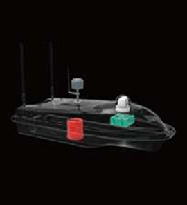
HYDROGRAPHIC SURVEY USV
Oceana SL40
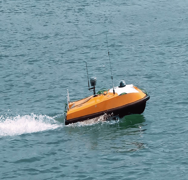
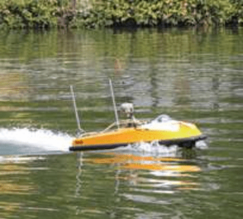
Powerful propulsion with maximum speed of 10 knots
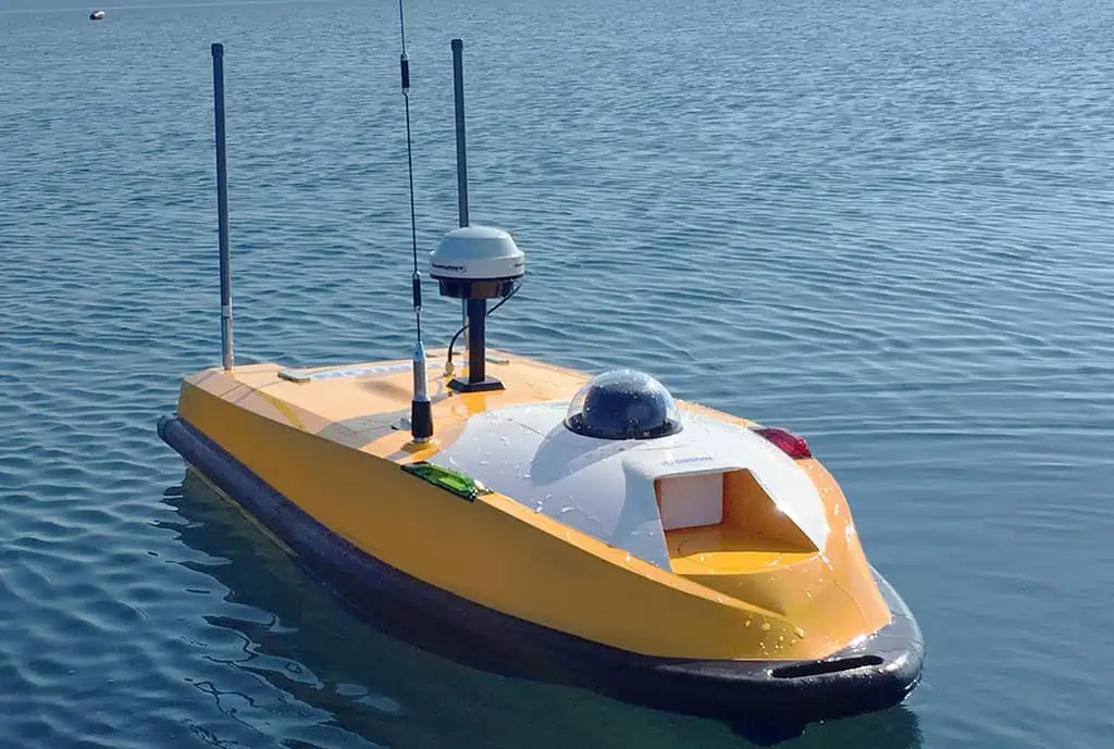
Water-jet thruster, great performance against debris and water plants
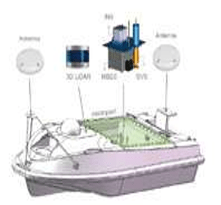
Strong expansibility, adaptable to a variety of surveying and mapping sensors

The mobile online survey function can check real-time data and video
Moon pool enables a quick switch between different payloads
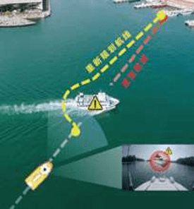
Support mission planning, autonomous navigation, and collision avoidance
Topographic and Cadastral Surveys
Topographic Surveys
Topographic surveys are performed to determine the planimetric location (horizontal position) and/or elevation (vertical position) of both surface and subsurface features in a particular area. These surveys are critical for:
Mapping existing structures and features such as buildings, breakwaters, embankments, utilities, and roads
Establishing ground levels and contours
Supporting design and construction planning across various civil and infrastructure projects
In certain cases, control points must be established near the survey area using locally available benchmark data to ensure positional accuracy.
Topographic surveys help provide maximum area coverage and detailed information in minimal time, especially when properly planned based on field conditions. Structures within the site can be coded appropriately to avoid any ambiguity during the preparation of final survey drawings and charts.
Cadastral Surveys
A cadastral survey is a specialized form of topographic survey focused on:
Demarcation of land boundaries using true geographic coordinates
Recording ownership history, succession data, and current legal status of the land
Determining the present market value of the property
These surveys are essential for:
Land record updates
Property title verification
Land acquisition processes for development projects
Legal and compensation settlements
Topographic Survey Equipment
A variety of instruments are used for conducting topographic and cadastral surveys, ranging from traditional tools to state-of-the-art technology:
Traditional Instruments:
Theodolites
Auto Levels
Dumpy Levels
Modern Equipment:
Total Stations
GNSS/GPS Systems
Terrestrial Laser Scanners
UAVs/Drones (for aerial mapping)
Survey Services Offered
We provide a wide range of surveying and mapping services, including:
Land Surveying & Levelling
All Types of Topographic Surveys
Corridor Alignments (Horizontal & Vertical) and Profile Surveys
As-Built Surveys
Demarcation of Plots / Cadastral Surveys
Traversing and Level Loop Surveys
Laser Scanning Surveys (LiDAR)
Quantity / Volumetric Surveys
Settlement Monitoring
Earthwork Volume Calculations
Underground Utility Detection & Mapping
Establishment of Control Stations and Benchmarks
Precise and Differential Leveling
Survey Consultancy and Check Engineering
Hiring of Survey Crews and Field Teams
Aerial Control Mapping